Wildfire updates: Foresthill ordered to evacuate as Mosquito Fire surges in Tahoe National Forest
READ MORE
Mosquito Fire
Click the arrow below for more coverage of the Mosquito Fire burning in Northern California.
Expand All
Thursday’s update: Critical infrastructure threatened as Mosquito Fire nears 7,000 acres
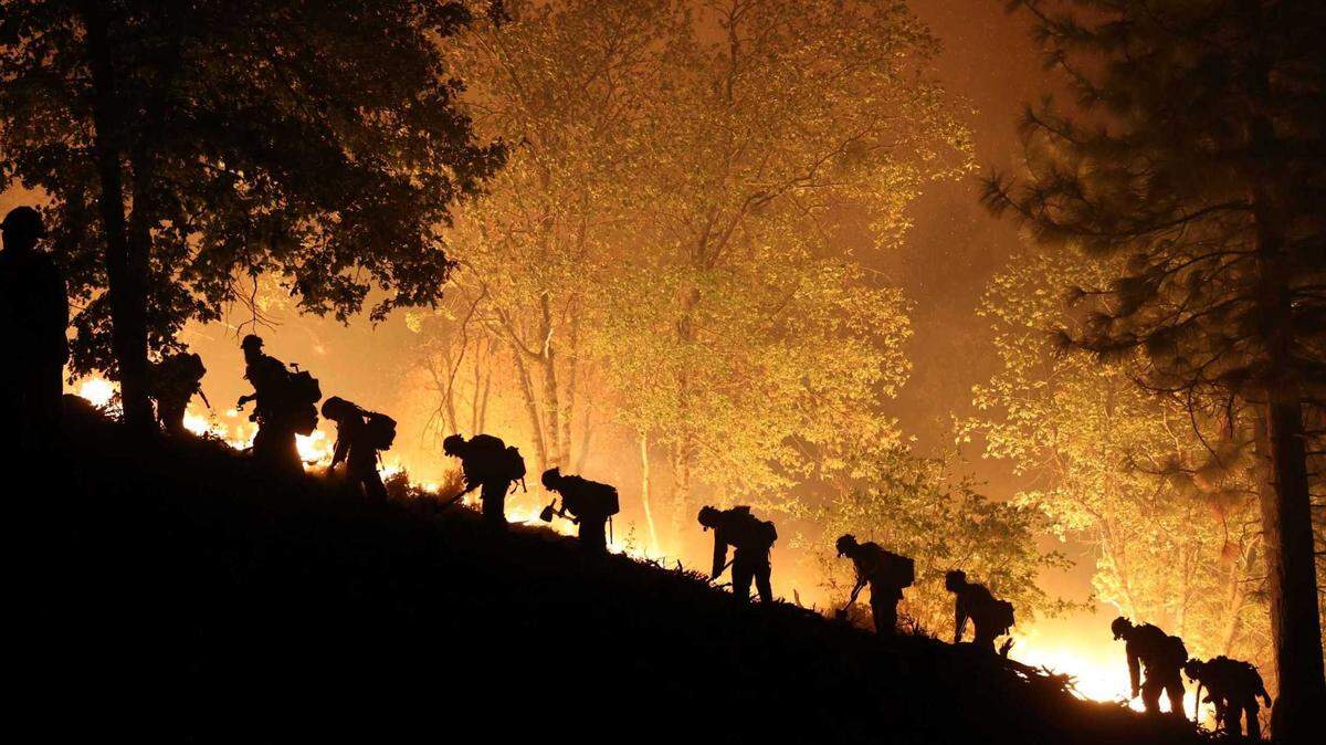
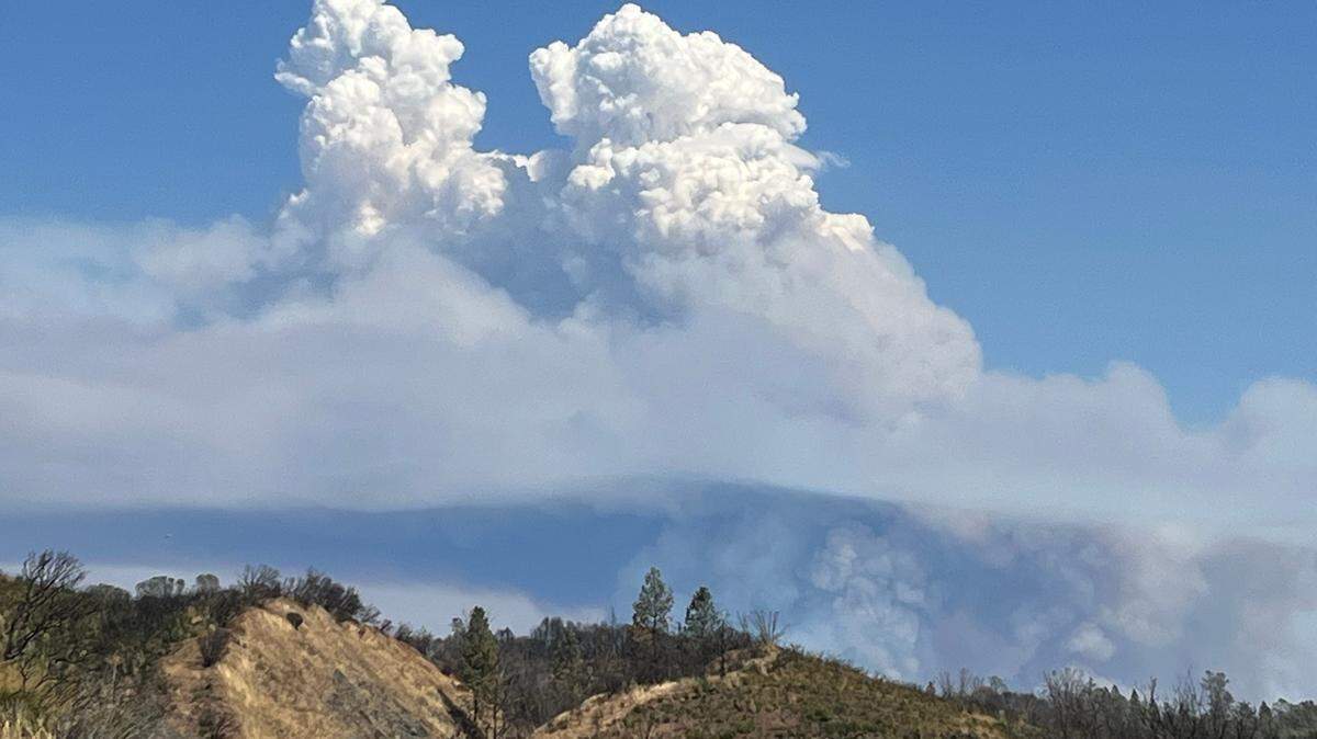
A wildfire that sparked Tuesday in the Tahoe National Forest just north of the border between Placer and El Dorado counties is displaying “extreme” fire behavior Wednesday, prompting mandatory evacuations including Foresthill, a town of about 1,500 people, and sending up a large smoke plume visible across the greater Sacramento area.
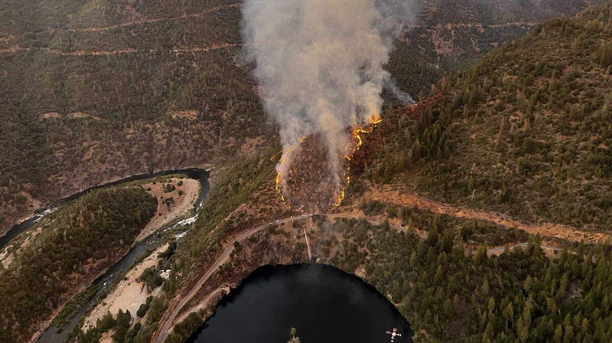
The Mosquito Fire, at first called the Volcano Fire when it started just after 6 p.m. Tuesday, was burning just north of Oxbow Reservoir along the Middle Fork of the American River, which divides El Dorado and Placer counties. The fire started east of Foresthill, according to the U.S. Forest Service, and was 0% contained.
Fire officials in an update shortly after 6 p.m. Wednesday reported the fire had burned 4,223 acres; up from 2,000 acres reported at 2:45 p.m. and 1,200 acres at 11 a.m.
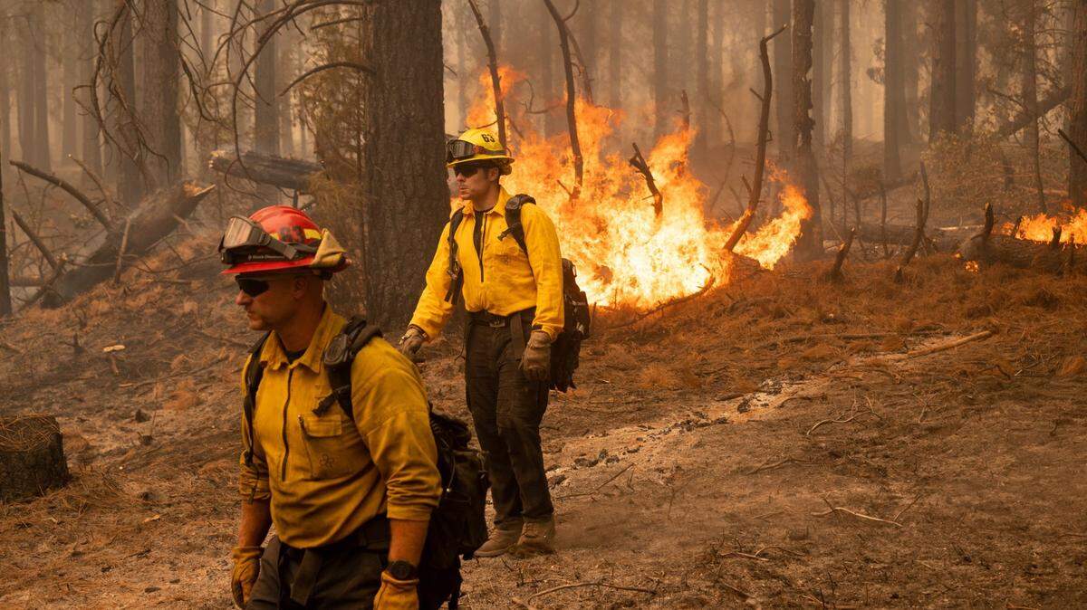
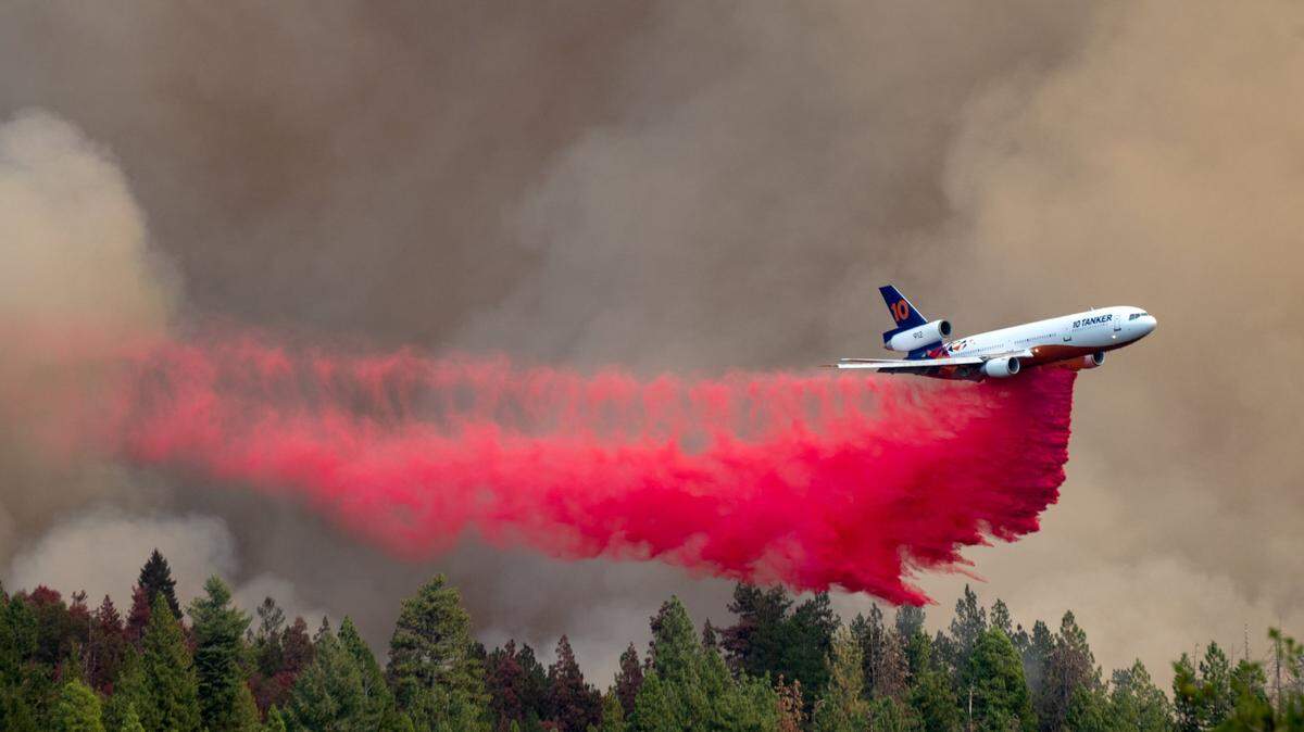
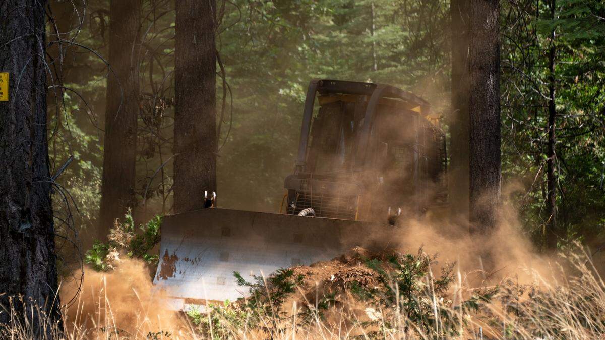
About 600 firefighters with additional units were battling the wildfire Wednesday evening, said Cal Fire Nevada-Yuba-Placer Division Chief Mike Rufenacht. The fire was 0% contained.
“As you’ve seen with the smoke column coming up, this fire continues to give us a hard time,” Rufenacht said during the Wednesday evening update.
Mandatory evacuations have not yet been expanded to include the Todd Valley area just south of Foresthill, Placer County Sheriff’s Office Lt. Josh Barnhart said in an afternoon video update, but residents should “stand by” and be ready to leave, he said.

Shortly after Foresthill was ordered evacuated, the Sheriff’s Office issued evacuation warnings for Todd Valley as well as other zones immediately east and north of Foresthill, according to an online evacuation map.
Cal Fire in a morning incident report said the fire “exhibited extreme fire behavior” Tuesday evening.
Significant growth and smoke activity continued Wednesday morning and afternoon.
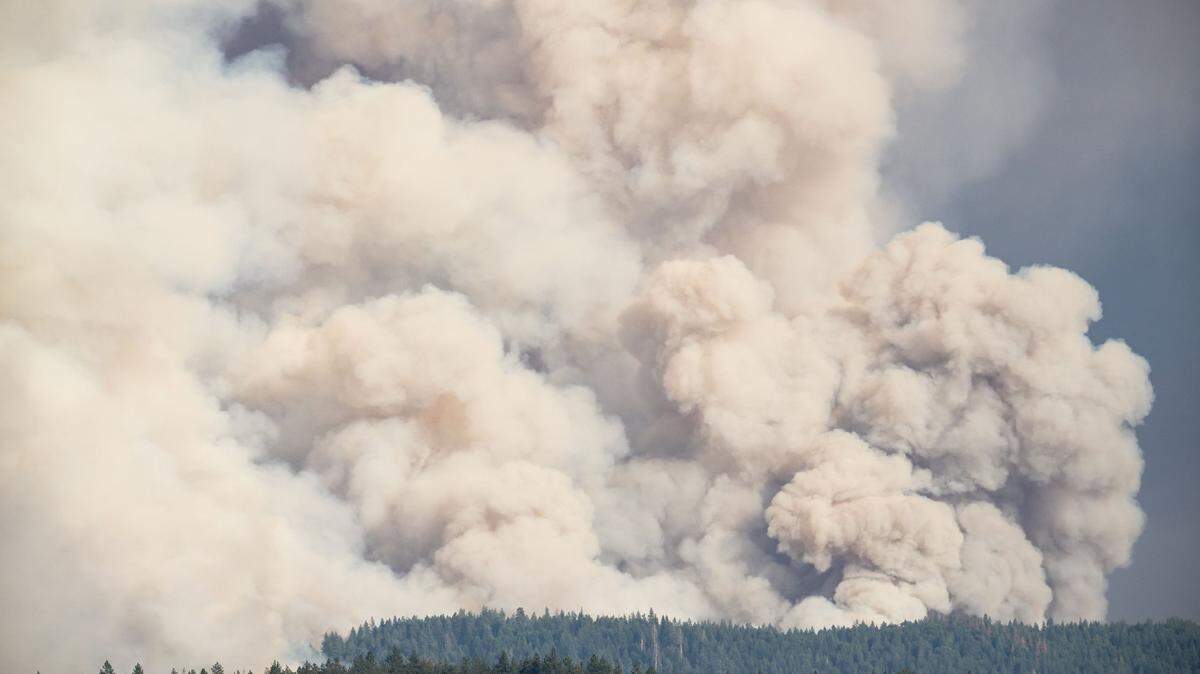
A huge, mostly vertical plume of light-colored smoke could be seen from numerous Northern California counties, picked up on several cameras operated by the Forest Service and Pacific Gas and Electric Co. that are part of the AlertWildfire network. The cloud of smoke could be seen prominently from cameras as far away as Butte and Amador counties, and from Tahoe-area ski resorts to the east.
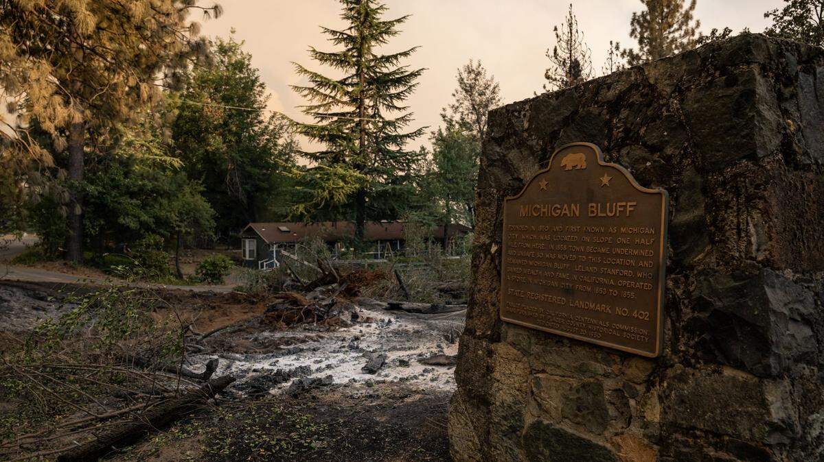
The Mosquito Fire was burning toward Foresthill and the Michigan Bluff area, Cal Fire Nevada-Yuba-Placer Division Chief Steve Robinson said in a video update Wednesday morning.

“We have resources all throughout Foresthill and are actively doing everything we can do to contain the fire,” Robinson said.
The evacuation of Foresthill came after a spot fire was reported about a mile from Foresthill Road, the Foresthill Fire Protection District said in an update just after 12:30 p.m.
The Fire Protection District called the incident a “serious major fire” on its website Tuesday, after the fire had spotted across water and continued to burn northeast toward Circle Bridge.

The Placer County Sheriff’s Office shortly upgraded an evacuation warning to a mandatory order for the town of Foresthill shortly before noon, joining evacuation orders for the areas of Michigan Bluff, Gorman Ranch, Chicken Hawk, Crystal View Lane, Bath Road, Hidden Treasure Road, Sequoia Way, Ridge View Road, Mosquito Ridge Road east of Soap Street and Baker Ranch Mobile Home Park.
The El Dorado County Sheriff’s Office on Wednesday upgraded evacuation warnings to a mandatory order for part of Volcanoville, in the area north of Wentworth Springs, east of Otter Creek, south of the Placer County line and west of Tunnel Hill Road. Residents in parts of Quintette are under an evacuation warning.
Foresthill High School was closed Wednesday due to the Mosquito Fire, Placer Union High School District officials said. Foresthill Divide School was also closed, “due to fire, power outages and heat,” Foresthill Union School District announced in social media posts.
The map of the evacuation area is available on the Placer County Sheriff’s Office website. The Sheriff’s Office says an evacuation shelter is set up at Bell Road Baptist Church, 707 Bell Road in Auburn. Animal Services is open for animal sheltering at 11232 B Ave., Auburn.
A temporary evacuation point is set up in El Dorado County at Cool Community Church, 863 Cave Valley Road, Cool.
Cal Fire’s Nevada-Yuba-Placer unit, which was assisting the firefighting efforts, posted aerial video of the fire, which was burning several yards above the reservoir in “very steep, inaccessible terrain” in an 8 p.m. update. Photos shared on social media overnight showed a plume from the fire visible in Auburn, about 20 miles west of the area.
Air pollution had reached “unhealthy” levels near Auburn by 7 a.m. Wednesday, according to an online map from the U.S. Environmental Protection Agency, which showed the region with an air quality index reading of 200 AQI. Air quality improved later in the day, to “moderate” levels of pollution as of 2 p.m.

On Tuesday morning, another fire several miles north called the Hill Fire prompted evacuations of campgrounds near Sugar Pine and Big reservoirs. That fire had chewed through 13 acres and was 60% contained, Cal Fire’s Nevada-Yuba-Placer unit reported Wednesday morning, up from 20% containment Tuesday evening.
Campgrounds in the area remain closed under an order from the Forest Service.
Mill Fire in Siskiyou County
Cal Fire reported the deadly Mill Fire, which started near Weed in Siskiyou County on Friday, remained at 3,935 acres (6 square miles) and increased to 75% containment as Wednesday evening.
Two civilians, women ages 66 and 73, were killed in the fire’s intense run late last week, authorities said. Three other civilians have been injured.
Crews observed “minimal” fire activity overnight. More than 600 personnel are assigned to the blaze, and about 900 residents remain evacuated, according to Cal Fire’s Wednesday morning incident update.
More than 90 structures have been destroyed, and teams are nearly finished assessing damage from the wildfire, which burned a historically Black neighborhood in northern Weed as well as parts of the Lake Shastina community.
A red flag warning was in place Wednesday afternoon and evening due to hot, dry weather with a chance of isolated dry thunderstorms.
Mountain Fire in Siskiyou County
The Mountain Fire, burning west of the Mill Fire and about nine miles southwest of the town of Gazelle, was 45% contained and remained at 11,690 acres (18 square miles), Cal Fire said Wednesday evening. The fire also sparked last Friday.
The fire did not grow overnight, though there were small flareups within control lines. As with the Mill Fire, a red flag warning is in place for the Mountain Fire zone due to possible wind gust and dry lightning.
Mandatory evacuations that had remained in place for about 60 residents were reduced to warnings at 1 p.m. Wednesday, according to Cal Fire.
Crews have tallied two destroyed buildings, with damage assessment nearly complete.
Fairview Fire in Riverside County
In Southern California, Cal Fire says the Fairview Fire has grown to 5,000 acres (8 square miles) with 5% containment. Numerous evacuation orders and warnings remain in place for the blaze, which ignited Monday afternoon near Hemet.
Authorities said the Fairview Fire has also killed at least two civilians.
This story was originally published September 6, 2022 at 10:34 PM with the headline "Wildfire updates: Foresthill ordered to evacuate as Mosquito Fire surges in Tahoe National Forest."