California wildfire updates: Dixie Fire nearing 900,000 acres as evacuations shift
READ MORE
California Wildfires
The latest on the wildfires burning in California. Get updates on the Caldor Fire, Dixie Fire and others, including size, containment, evacuation orders and more.
Expand All
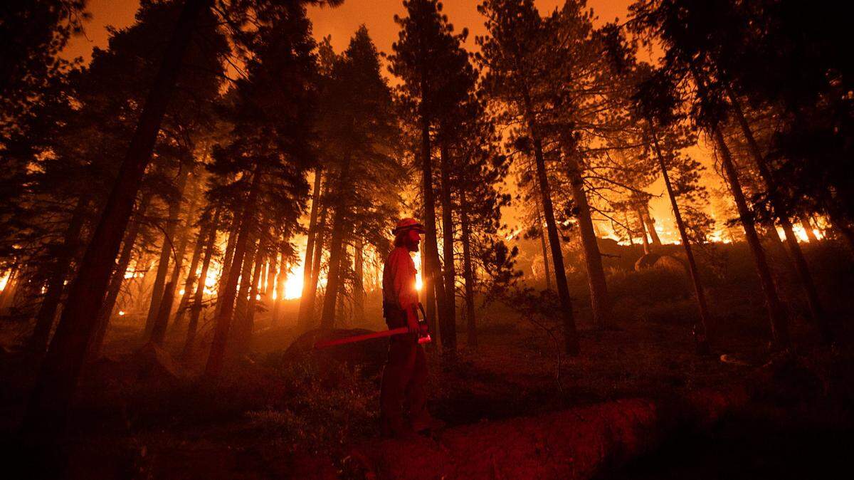
The Dixie Fire, California’s second-largest wildfire ever recorded, surpassed 850,000 acres this week.
Authorities have made numerous changes in evacuation orders — some new ones introduced and older ones eliminated or reduced to warnings — as activity has ebbed and flowed around the sprawling perimeter of the fire.
The blaze is nearly two months old. It sparked July 13 near the Cresta Dam in Feather River Canyon and has flared multiple times amid gusty winds, including this week with red-flag winds Monday through Wednesday.
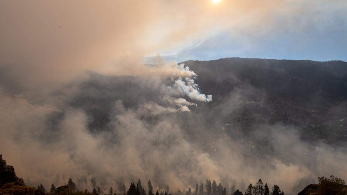
The fire has reached 868,781 acres (1,357 square miles) with 55% containment, Cal Fire and the U.S. Forest Service stated in a joint update Friday morning. Authorities said the fire burned “actively through the night with terrain driven winds.”
The Dixie Fire is burning in parts of Butte, Plumas, Lassen and Tehama counties, mostly near sparsely populated areas. It has also burned a large portion of Lassen and Plumas national forests.
The Governor’s Office of Emergency Services reported Thursday morning that about 2,700 residents remain evacuated, most of them in Plumas County. The Caldor Fire in El Dorado County, by comparison, has displaced about 48,000.
The Plumas County Sheriff’s Office lifted a mandatory evacuation order for the Greenville area Friday, and on Thursday downgraded some mandatory orders to warnings for areas north of Highway 36. Meanwhile, Lassen County sheriff’s officials on Wednesday ordered new evacuations near the communities of Milford and Herlong, east of Highway 395, due to flaring.
Sheriff’s officials on Thursday afternoon lifted all remaining evacuation warnings for Tehama County, which had been in place for areas just north of Highway 36 near the Butte and Plumas county lines.
Cal Fire and the Forest Service say nearly 13,000 structures are threatened, a total that includes structures under mandatory evacuation orders and voluntary warnings.
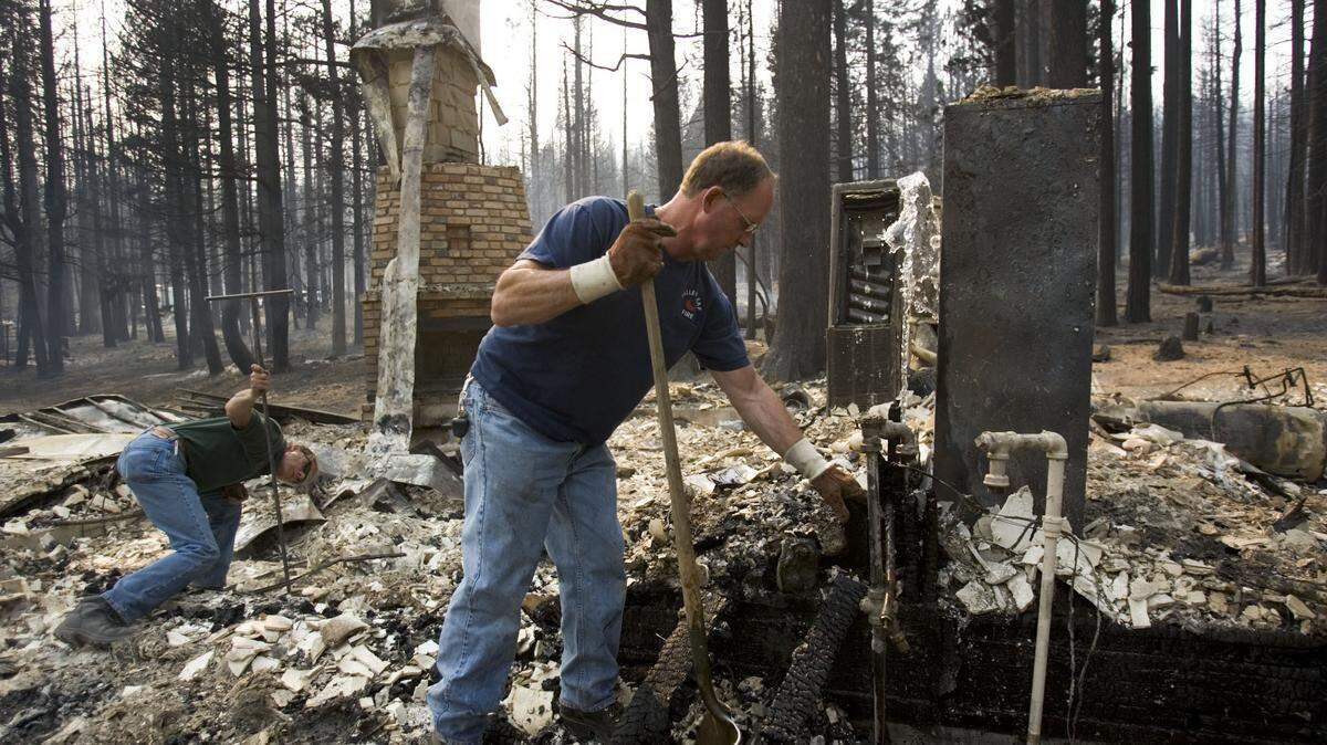
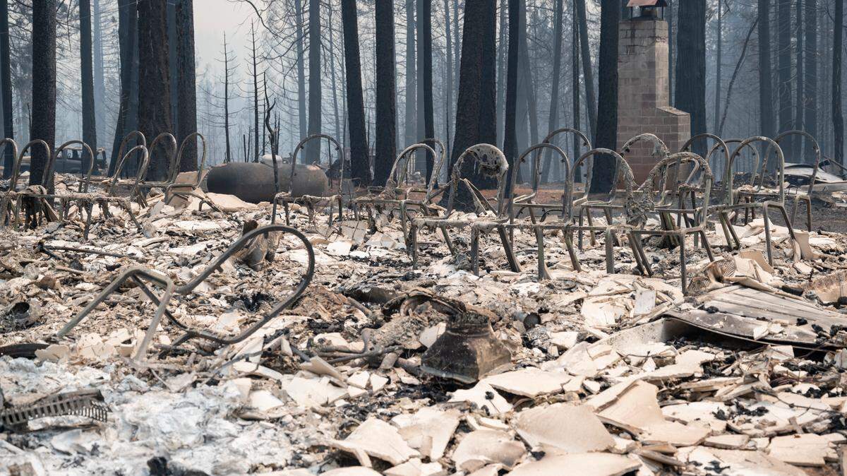
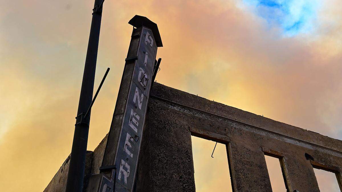
The blaze has destroyed nearly 700 homes, close to 140 businesses and hundreds of minor structures, fire officials said Thursday. Damage assessment remains ongoing, Cal Fire said in Friday’s update.
Authorities have split the vast incident into a west zone and an east zone. Both zones are working to keep the fire away from Highway 395, according to the update from Cal Fire and the Forest Service.
The west zone is also “working aggressively” for containment and structure protection near the communities of Janesville, Milford, Buntingville, Herlong and Junction, according to Thursday’s update. Crews on the east zone are trying to bolster dozer lines to protect areas along Highway 70.
The official cause of the fire remains under investigation, but Pacific Gas and Electric Co. in a filing to the state’s utility regulator said one of its employees located a “healthy green tree” leaning on one of PG&E’s power poles near the origin point of the fire.
Other California wildfires still burning
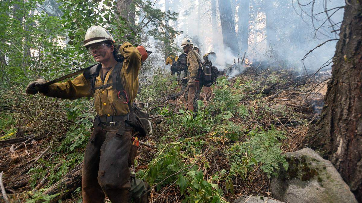
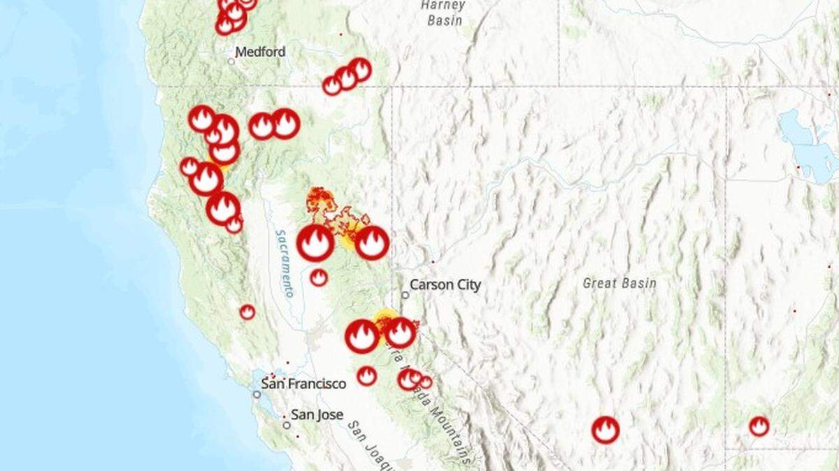
As of Thursday morning, more than 15,300 firefighters continued to battle 16 major wildfires and five extended attack wildfires burning throughout California as flames threatened more than 57,500 structures. Cal Fire officials said 20 new initial attack wildfires were sparked on Wednesday and quickly extinguished.
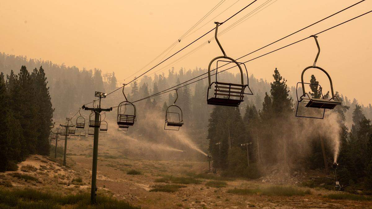
As Labor Day weekend approaches, the U.S. Forest Service has temporarily closed all National Forests in California through Sept. 17 due to the burning wildfires. California has temporarily closed until further notice several state parks in and around the Lake Tahoe Basin as firefighters continue trying to corral the Caldor Fire, which Cal Fire says is the 15th-largest fire in California history.
French Fire
Firefighters had 43% containment of the French Fire in Kern County, where flames had burned 25,871 acres, according to Cal Fire. The fire, west of Lake Isabella in the Sequoia National Forest, continues to burn amid gusty winds and low humidity.
But there was a bit less wind Thursday, and a lot of areas were not in alignment to support rapid growth, according to the latest incident update. Evacuation orders and warnings in the area remained in place, and the estimated full containment was set for early Tuesday.
Airola Fire
Cal Fire officials said there was “minimal fire activity” Thursday on the Airola Fire, which started burning Aug. 25 near Vallecito in Calaveras County. Flames there have burned 639 acres, and the fire was 92% contained as of Thursday evening.
Crews are conducting mop-up operations, suppression repair and patrol. Cooler high temperatures helped Thursday, with a slight increase in humidity and calmer wind.
Trinity County wildfires
Two lightning-sparked wildfires, the Monument and McFarland fires, continued to burn near Trinity County.
The Monument Fire, west of Big Bar in Shasta-Trinity National Forest, had burned 177,222 acres and was 33% contained, Cal Fire reported Friday morning.
The Monument Fire, the 20th largest fire in California history, is threatening about 8,200 structures. Evacuations orders and warnings remain in place; however, some areas have been deemed safe for re-population.
Firefighters have had more success with the McFarland Fire, west of Platina in the Shasta-Trinity National Forest, which had burned 122,653 acres but was 98% contained, Cal Fire reported.
McCash Fire
In Siskiyou County, the McCash Fire has burned 48,733 acres since it started Tuesday. Firefighters had 1% of the fire contained, and officials there don’t expect to have it fully contained until Oct. 31.
The fire, caused by lightning in the Six Rivers National Forest, is expected to grow farther into the wilderness toward the east, along with a spot on the northwest of the fire that will also continue to grow.
River Complex Fire
The River Complex Fire has burned 114,359 acres in Siskiyou and Trinity counties and was 15% contained. Officials said containment, previously reported at 23%, decreased because of the fire’s growth and more accurate mapping.
The fire caused by lightning started Monday morning and has burned areas in the Klamath and Shasta-Trinity national forests.
This story was originally published September 2, 2021 at 4:28 PM with the headline "California wildfire updates: Dixie Fire nearing 900,000 acres as evacuations shift."

.JPG)