Sacramento suburbs have some of the highest wildfire risk in California, new report shows
READ MORE
Wildfire Risk in California
Click the arrow below for more coverage on the wildfire risks in the Sacramento region and California.
Expand All
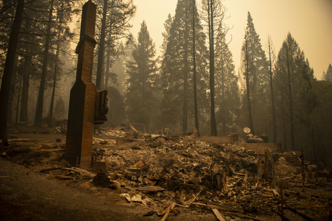
A new report released this week by a U.S. climate research nonprofit estimated that more than 4.6 million properties in California, or about 40% of the state, have at least “moderate” risk of burning in a wildfire some time in the next three decades.
So where, according to First Street Foundation’s analysis, is the fire risk highest in the four-county capital region of Sacramento, El Dorado, Placer and Yolo?
A “risk factor” online tool accompanying the organization’s Monday report gives estimated risk levels for incorporated cities as well as individual neighborhoods.
It also allows users to type in their own home address, to find out their own personal estimated risk level.
Dangers in Placer, El Dorado and Yolo counties
Cameron Park, El Dorado Hills, Pollock Pines, Lincoln, Loomis, Newcastle and parts of Folsom and Roseville are among areas with a “severe” community wildfire risk factor, according to the First Street tool.
“This is based on the level of risk the properties face rather than the proportion of properties with risk,” the online tool explains.
Searches using the tool appear to turn up only one local incorporated city in the “extreme” category, a level above severe and the highest on First Street’s scale: Winters, a rural Yolo County city of more than 7,000 residents.
Several large vegetation fires have already burned in recent years close to Winters, including the July 2017 Winters Fire that burned more than 2,200 acres about 3 miles from the city.
Folsom and Roseville could see ‘major’ risk
As for Sacramento’s larger suburbs, the tool says more than 34,000 homes out of nearly 45,000 surveyed in Roseville “have some risk of being affected by wildfire over the next 30 years,” as well as nearly 20,000 of about 22,000 surveyed in Folsom.
Folsom and Roseville as a whole are classified as at “major” wildfire risk – a step below severe, though some neighborhoods within each are shown with severe risk.
Blue Oaks, a neighborhood in the relatively sparse northwestern corner of Roseville, is categorized as having severe risk with all 2,895 of its homes as of First Street’s analysis having some risk of burning. A 65-acre fire in August 2020 burned near Blue Oaks.
The nonprofit’s map also shows dark red patches along the Highway 50 corridor near the Sacramento-El Dorado county line, including the new Folsom Ranch subdivision just south of the freeway and Folsom’s Empire Ranch neighborhood in hills adjacent to El Dorado Hills.
Other suburbs near the capital city, including Rancho Cordova and Rocklin, also have major risk, according to First Street’s data modeling, along with Auburn, Colfax and Placerville.
Natomas is Sacramento’s most at-risk neighborhood
Wildfire risk levels in Sacramento city limits, Davis, Elk Grove, Galt, West Sacramento and Woodland are all labeled “moderate,” while Citrus Heights is a step better at “minor” fire risk.
Some Sacramento neighborhoods do have major risk, including the Natomas Park area, according to the First Street risk factor tool, as well as nearby Rio Linda in unincorporated Sacramento County.
Isleton, along the Delta, is the only incorporated city in the region listed as having “minimal” risk, “unlikely to be impacted by wildfire over the next 30 years,” according to First Street’s web tool.
The risk factor tool provides relatively broad estimates, and a lower risk rating does not mean a devastating wildfire cannot emerge in a location. South Lake Tahoe, for instance, is classified by First Street as having only moderate wildfire risk – even after the raging Caldor Fire forced the evacuation of the entire city for several days last fall.
The high-risk areas noted in First Street’s analysis appear to roughly align with and expand on Cal Fire’s fire hazard severity zones maps, which have not been updated since 2007. The map for Sacramento County, for example, shows areas near Folsom with moderate wildfire risk but shows Rancho Cordova as low risk; Cal Fire’s map for Yolo also lists Winters as having moderate risk.
This story was originally published May 16, 2022 at 12:53 PM with the headline "Sacramento suburbs have some of the highest wildfire risk in California, new report shows."

.JPG)