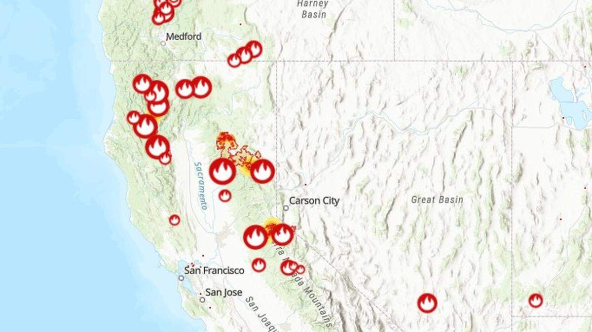
Wildfire updates: Dixie Fire 3rd largest in California history, sends smoke to Sacramento
READ MORE
California Wildfires
The latest on the wildfires burning in California. Get updates on the Caldor Fire, Dixie Fire and others, including size, containment, evacuation orders and more.
Expand All
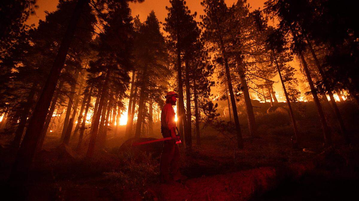
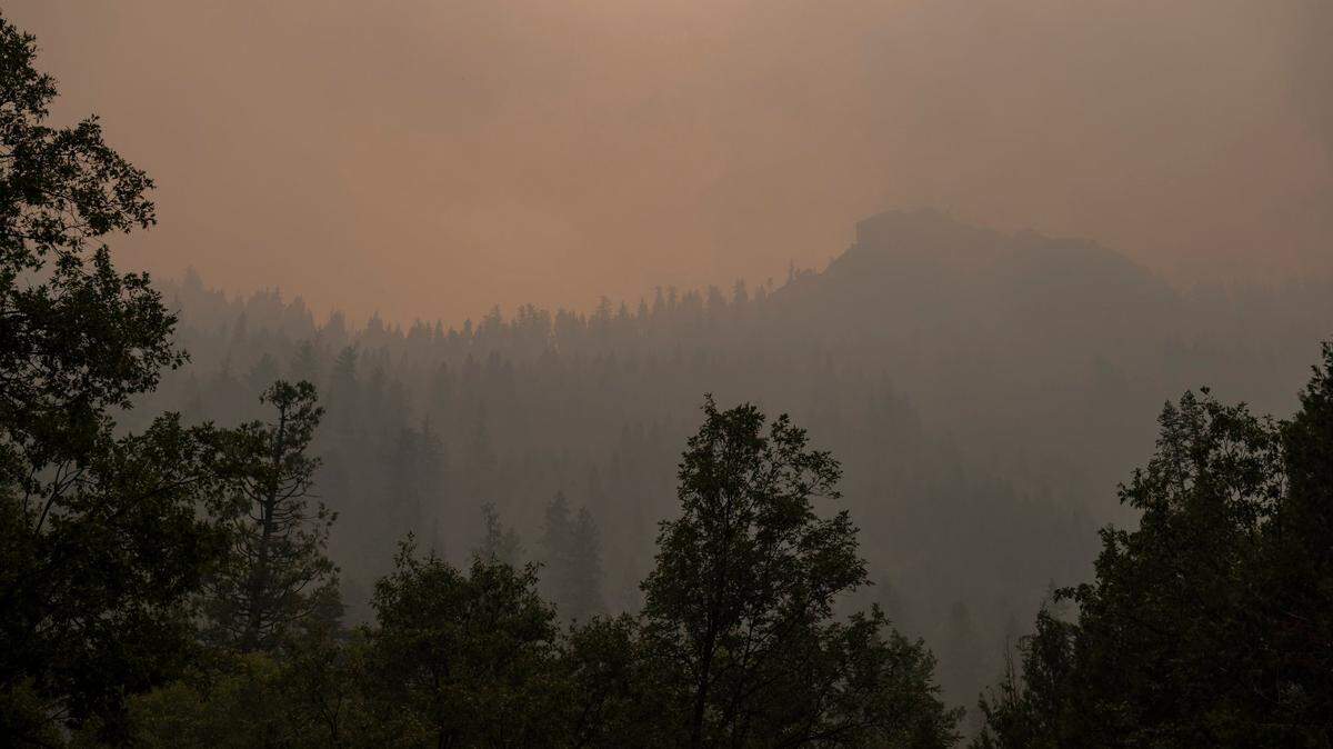
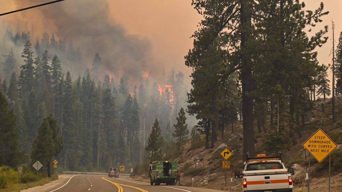
Crews could not contain the Dixie Fire heading into Friday as it expanded 110,000 acres under red flag weather conditions, becoming California’s third largest wildfire of all time.
Although the red flag warning lifted Thursday night and weather conditions are expected to improve Friday, officials have yet to see an end in sight as the blaze continues to threaten numerous towns in Plumas County and spews smoke into the Sacramento Valley.
“We’re starting on a bit of a more moderate weather cycle, but it’s relative,” said fire behavior analyst John Cook in a Friday morning incident briefing. “I mean moderate compared to what it did a couple days ago? That was crazy. The pressure is not off … this fire is not over.”
In its morning incident report, the state fire agency said the fire encompassed 432,813 acres (676 square miles) — an area 14 times the size of the city of San Francisco. The fire has nearly doubled in size since Sunday and containment has remained stagnant at 35% through the week.
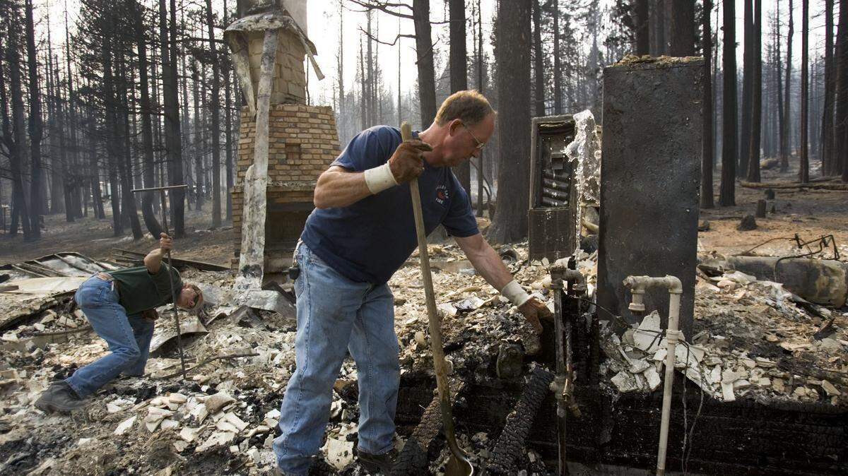
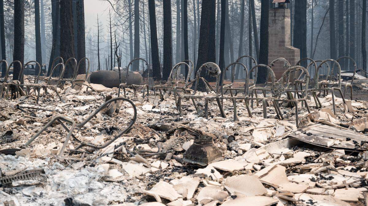
High winds that began Wednesday afternoon propelled the fire’s rapid expansion through the last 48 hours. On Wednesday, the fire entered the town of Greenville and burned nearly every structure in the town’s main area to the ground. On Thursday evening, it did the same to Canyondam, a smaller town to the northwest of Greenville.
The towns of Chester, Westwood and the Lake Almanor peninsula have faced similar threats as the fire expanded to the north, up past Lake Almanor. “If you are still in the area, you are in danger and you MUST leave now!!” wrote the Plumas County Sheriff’s Office in a social media post midday Thursday, regarding the small towns.
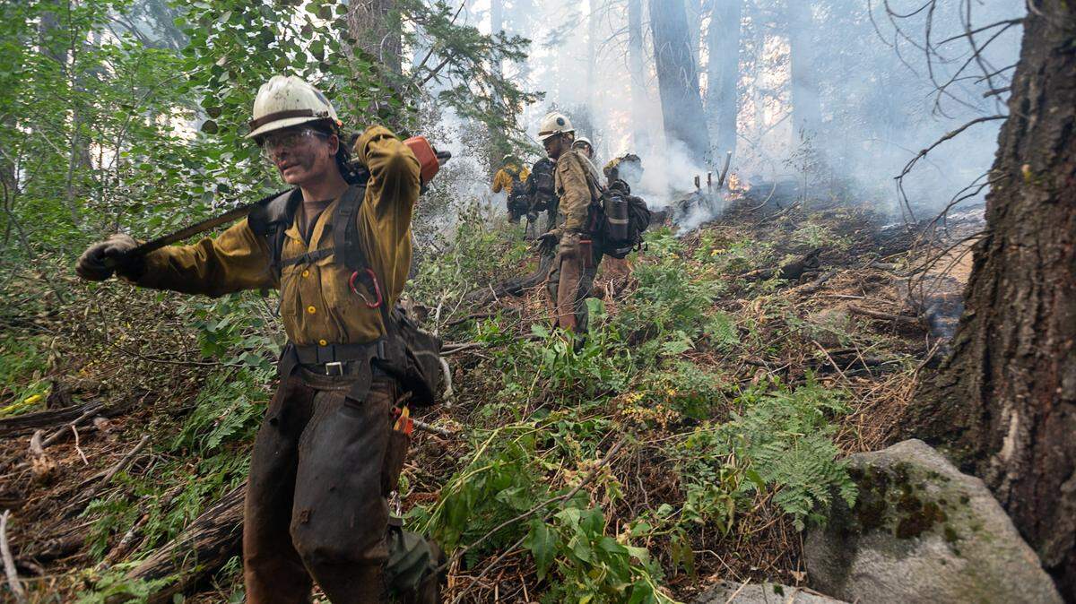
Just over 5,000 firefighters are battling the fire, which ignited three weeks ago above the Cresta Dam in Feather River Canyon in the burn scar of the deadly 2018 Camp Creek fire. Officially, the fire’s cause remains under investigation, but Pacific Gas and Electric Co. disclosed shortly after the fire began that its equipment may have played a role in the wildfire’s ignition.
Evacuation orders and warning are in place in Butte, Plumas, Tehama and Lassen counties. A full list of evacuations spanned eight page’s of Cal Fire’s Friday incident report.
The fire has destroyed 143 structures, more than doubling its destruction from the beginning of the week. Cal Fire estimated Friday morning that over 13,871 structures remain threatened by the fires.
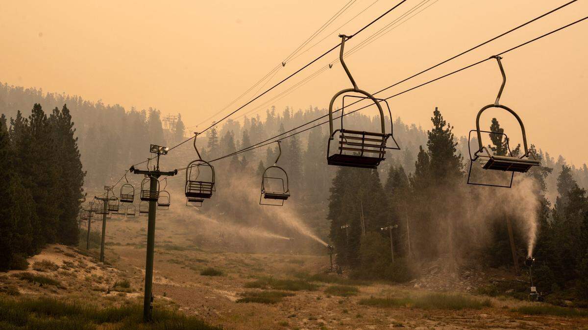
Although wind levels have relaxed at the Dixie Fire, higher atmosphere winds are expected to push smoke into the Sacramento area Friday. In a Thursday news release, the Sacramento Metropolitan Air Quality Management District warned residents that smoke would enter the area Friday and remain through Sunday, raising the AQI to dangerous levels.
“Northerly and northwesterly winds will transport smoke from the fire complexes in northwestern California into the Sacramento region,” read the news release. “While a wind shift Saturday night may provide some relief, the clean-out will be slow and better air quality is not expected until Sunday afternoon.”
Although AQI levels remained in the healthy range as of 8 a.m. Friday, smoke was visible in much of the Sacramento area, creating a hazy morning and painting the sun a red shade. Air quality conditions are expected to deteriorate throughout the day.
River Fire
Crews have managed good progress on the River Fire, which started Wednesday afternoon near Colfax and grew explosively in its early hours before conditions calmed Thursday.
Cal Fire on Friday reported containment at 30%, up from 15% the previous evening, with minimal growth to a total of 2,600 acres.
The fire has destroyed at least 88 structures, most of them homes, and continues to threaten another 3,400, Cal Fire’s Nevada-Yuba-Placer unit said in a Friday morning incident report. Damage assessment teams are still working to examine the extent of destruction.
Evacuation orders remain in place for the city of Colfax west of Interstate 80, near Mount Olive and other nearby areas.
Several voluntary evacuation warnings were lifted early Friday afternoon, including east of I-80 near Rollins Lake in Placer County and several zones in Nevada County, including the east edge of Alta Sierra.
Detailed evacuation information is provided by the Placer County Sheriff’s Office and Nevada County Office of Emergency Services.
Two civilians and one firefighter have been injured in the blaze. No fatalities have been reported.
More than 1,300 fire personnel are assigned to the incident.
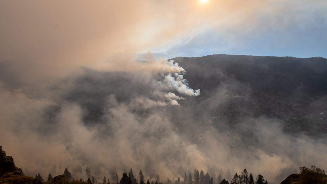
The fire sent up a huge plume of smoke Wednesday that could be seen from Sacramento. Activity died down considerably Thursday, though fire crews stayed on high alert as gusty winds remained in the forecast.
Evacuation centers remain set up at Regional Park gymnasium in Auburn, and at Bear River High School in Grass Valley. Animal evacuation centers are at the Placer County Animal Services Center in Auburn and the Nevada County Fairgrounds in Grass Valley.
The cause of the River Fire remains undetermined.
Antelope Fire
Another lightning-ignited wildfire, the Antelope Fire near the Antelope Creek drainage in Siskiyou County, erupted to nearly 22,605 acres this week amid “extreme” fire conditions including heavy wind gusts. There is no containment.
The Siskiyou County Sheriff’s Office has evacuation orders in place for: Tennant, Bray, Mount Hebron, and Round Valley area south of Red Rock Road, including Long Prairie Road, Robison Road and Old State Highway.
The Antelope Fire started Sunday. Nearly 400 fire personnel are assigned.
Shasta-Trinity July Lightning Complex
A pair of large, lightning-sparked wildfires continue to burn at Shasta-Trinity National Forest.
The McFarland Fire near Wildwood south of Highway 36 grew to 26,598 acres and was 7% contained as of a Friday morning update from the U.S. Forest Service. Evacuation orders remain in place for Wildwood residents, and Highway 36 is closed in the area.
The Forest Service said fire behavior was moderate Thursday but that “forecasted stronger winds (were) just starting to impact the fire area and could increase the rates of spread.” The fire is burning in steep terrain.
Officials aid the southeast zone of the fire was active Thursday night and became “established” on Little Red Mountain. The southern flank of the fire is expected to burn toward the scar of the August Complex, California’s largest wildfire ever, which scorched over 1 million acres in 2020.
The Monument Fire is reported at 36,015 acres with no containment, the Forest Service said Friday morning. It is burning west of Big Bar, threatening that community as well as Del Loma, Big Flat and Cedar Flat, all of which have mandatory evacuation warnings in place.
Big Flat evacuees may go to the Red Cross Shelter in Weaverville, on Main Street.
Crews focused efforts Thursday night on structure protection along both sides of Highway 399.
The Forest Service in a situation report said the fire is burning timber, grass and brush “that is extremely dry due to drought conditions,” and that firefighting resources are limited due to other major wildfires burning in Northern California.
“While smoke continues to be a major issue today, one result of heavy smoke and inversions is that when we have difficulty breathing, so does the fire,” the Forest Service said in a Friday news release.
Both the McFarland and Monument fires sparked in late July during a lightning storm, Forest Service officials say.
This story was originally published August 6, 2021 at 8:30 AM with the headline "Wildfire updates: Dixie Fire 3rd largest in California history, sends smoke to Sacramento."

.JPG)