Wildfire updates: Dixie Fire approaches towns of Chester and Greenville after explosive growth
READ MORE
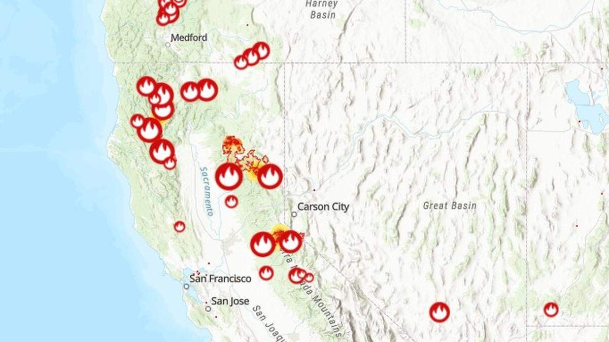
California Wildfires
The latest on the wildfires burning in California. Get updates on the Caldor Fire, Dixie Fire and others, including size, containment, evacuation orders and more.
Expand All
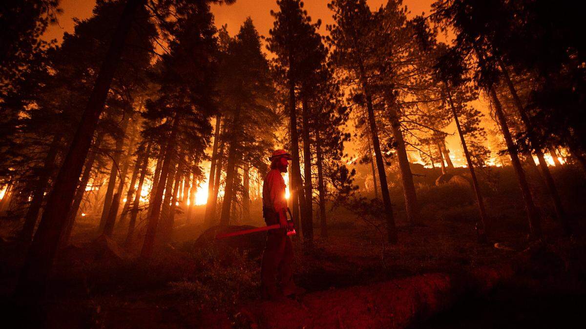
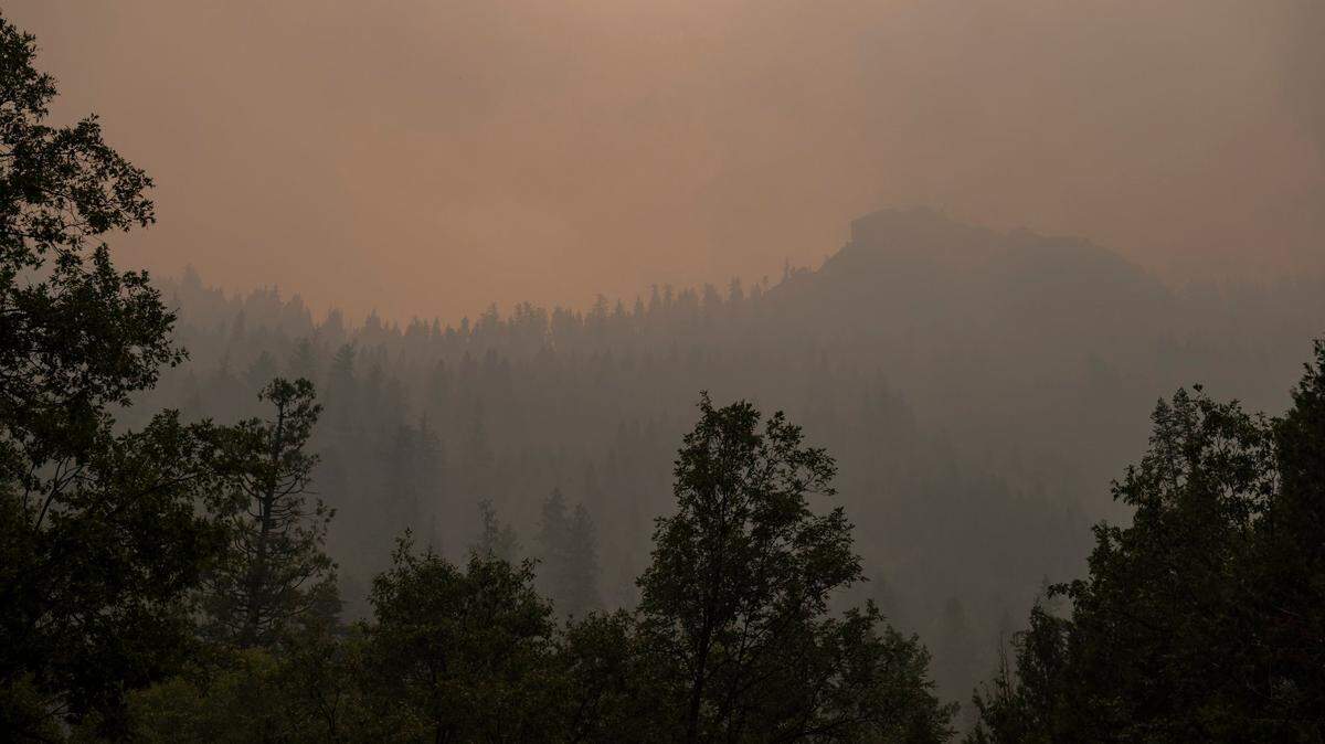
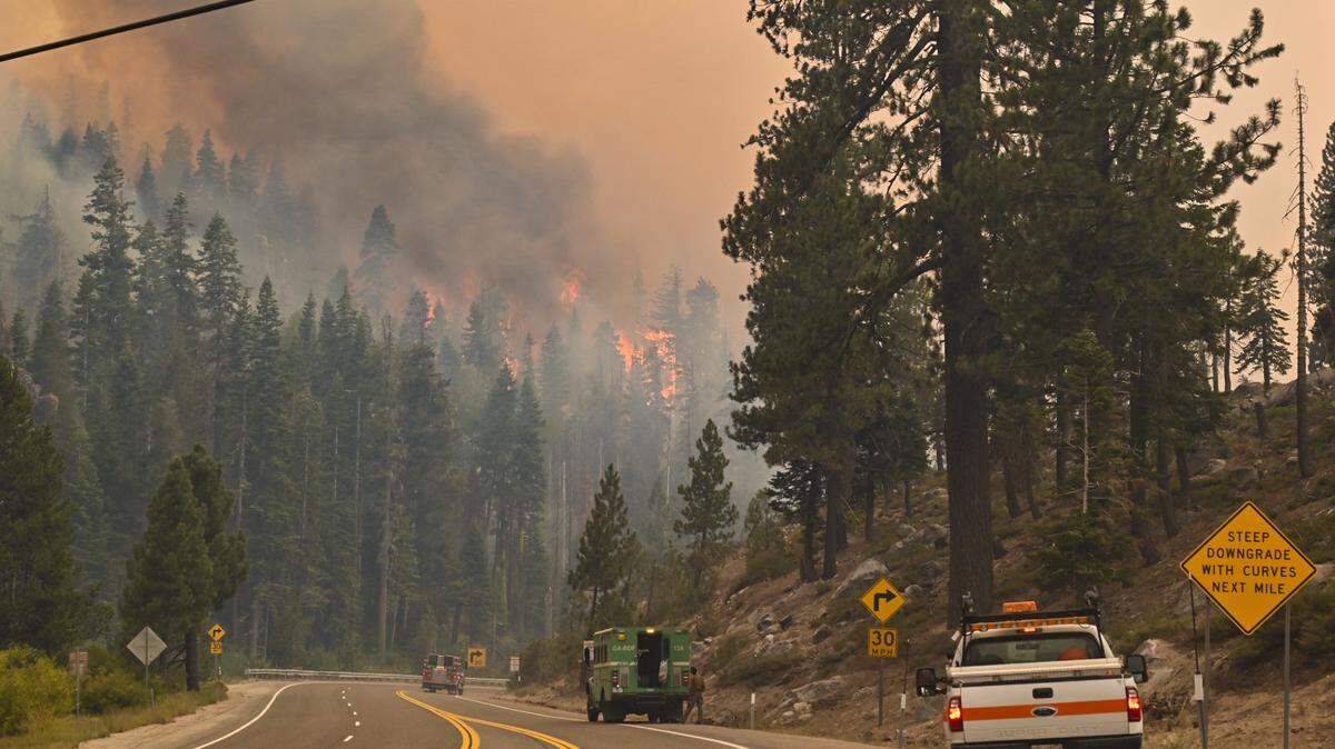
The massive Dixie Fire exploded Wednesday, expanding over 20,000 acres and causing officials to issue new evacuation orders as crews struggled to contain the fire.
Thursday update: Blaze rips through Greenville, leveling downtown; Dixie Fire now at 322K acres
And as of Wednesday afternoon, the fire began to take aim at towns in the Lake Almanor area.
The wildfire has approached the town of Chester, prompting the Plumas County Sheriff’s Office to issue a dire warning to residents.
“If you remained you should evacuate to the EAST, IMMEDIATELY!” the Sheriff’s Office wrote in a social media post. “If you cannot evacuate and you are threatened by fire and can safely get there, take refuge at the Chester High School baseball field!”
Firefighters in the area were reportedly spraying structures with retardant in preparation for the fire to potentially burn over the town.
The blaze also approached the town of Greenville south of Lake Almanor. The Plumas County Sheriff’s Office warned all Greenville residents to evacuate to the nearby town of Quincy immediately due to a potential burn over.
“If you are still in the Greenville area, you are in imminent danger and you MUST leave now!!” the Sheriff’s Office wrote in a social media post.
The blaze has exhibited critical behavior throughout the day Wednesday as a red flag warning went into effect. Hot and dry conditions have created major spotting at the blaze, said Cal Fire officials, and erratic wind patters have created massive pyrocumulus clouds over the northwest portion of the fire.
In its morning incident report, the state fire agency said the fire encompassed 274,139 acres (428 square miles) — an area nine times the size of the city of San Francisco. Containment remained stagnant at 35% between Tuesday and Wednesday.
Rapid growth overnight propelled the blaze to become the 8th-largest in state history by acres burned.
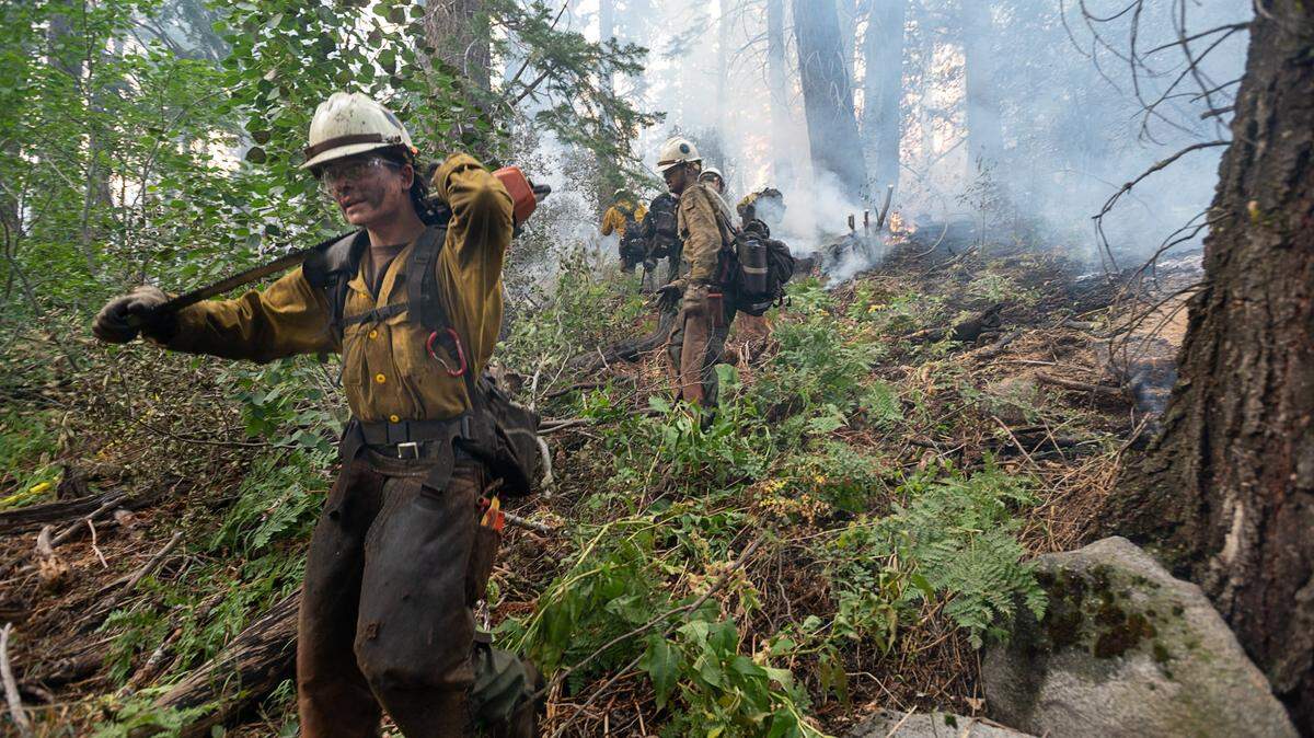
Just under 5,000 firefighters are battling the fire, which ignited July 14 above the Cresta Dam in Feather River Canyon in the burn scar of the deadly 2018 Camp Creek fire. Crews are fighting the fire in two zones: the east, which is managed by the U.S. Forest Service, and the west, which is managed by Cal Fire.
In the Wednesday morning update, officials attributed the fire’s rapid growth to unstable weather conditions through the day Tuesday. High temperatures and low humidity allowed the fire to surge, while winds pushed the fire north past containment lines.
But weather conditions may prove to be even worse Wednesday and Thursday. A red flag warning comes into effect through Thursday at 8 p.m., and officials warned Wednesday morning of high level winds and low humidity that could create rapid expansion.
“All the fire danger today is maxed out ... this is all lining up against us,” said fire behavior analyst John Cook. “It will spot, it will run, it will torch … We’re not doing anything wrong, this is just a very, very bad situation.”
Officials issued new evacuation orders in Plumas County Tuesday evening as the north front of the fire expanded rapidly. The entirety of the town of Chester, the Lake Almanor peninsula and the whole northeast side of Indian Valley are now under evacuation orders.
The new orders add on to a series of evacuation orders and road closures already in place across Plumas County and northeast Butte County.
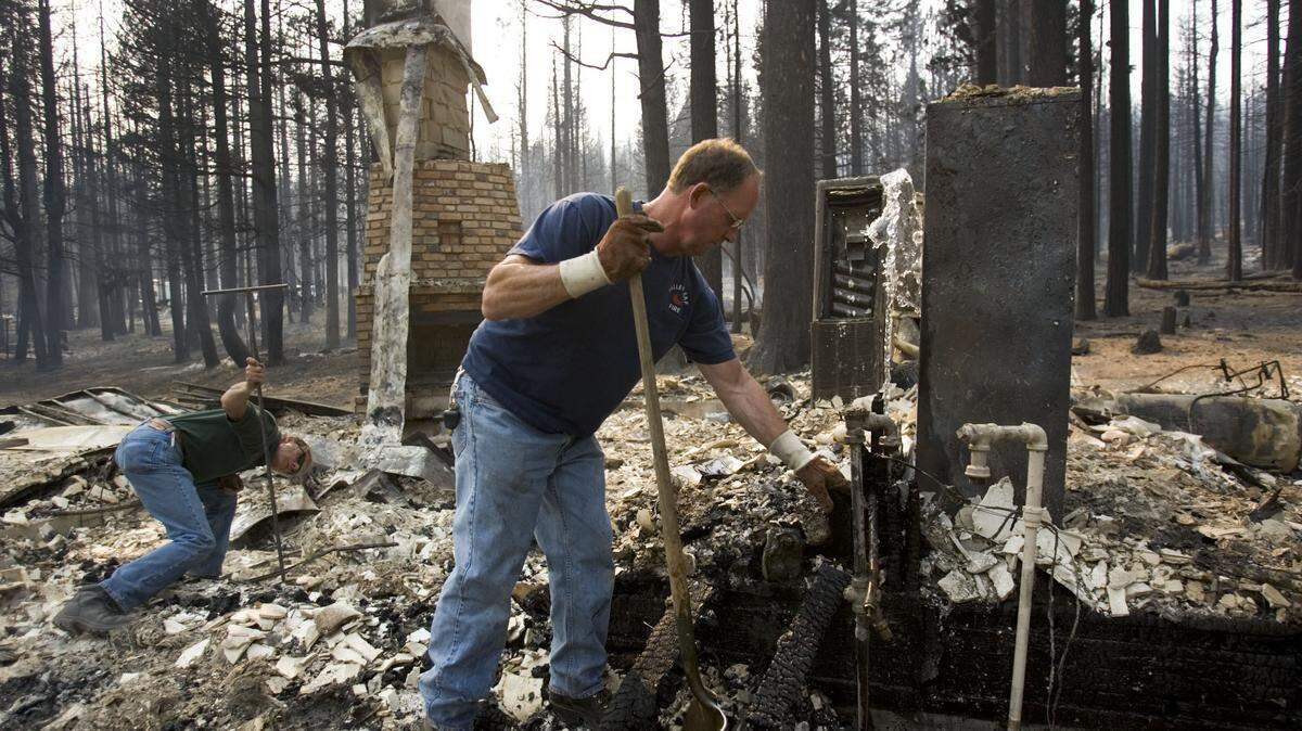
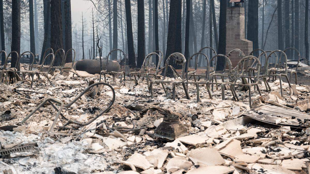
A total of 67 structures have been destroyed by the fire, and the Associated Press reported that the small town of Indian Falls accounted for more than half of those losses. Cal Fire estimated Wednesday morning that over 12,180 structures remain threatened by the fires — up 5,000 from the estimate Tuesday morning.
Officially, the fire’s cause remains under investigation. But Pacific Gas and Electric Co. disclosed shortly after the fire began that its equipment may have played a role in the wildfire’s ignition. On Monday, PG&E told public regulators that its equipment might also be to blame for the Fly Fire, which ignited east of the Dixie Fire on July 22 and later merged with the blaze.
River Fire
The River Fire sparked Wednesday afternoon near Colfax, prompting authorities to issue numerous evacuation orders in Placer and Nevada counties.
Crews first responded to the Bear River Campground at 2:30 p.m. on reports of a small vegetation fire. Since then, the fire has expanded rapidly, jumping the river into Nevada County and now expanding on both sides of the river.
The fire has ballooned to around 1,000 acres around three hours after it began, according to the Cal Fire Nevada-Yuba-Placer unit.
The fire is 0% contained. Officials have issued evacuation orders for the Bear River Campground, Sierra Knoll Estates and parts of Mount Olive road and Dog Bar road. A full list of evacuation zones can be viewed here.
The blaze is threatening numerous structures in the area, the Nevada County Office of Emergency Services said. Part of Highway 174 is closed as crews fight the fire.
Trinity County wildfires
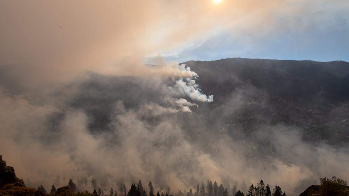
Large thunderstorms last week sparked multiple blazes in the Shasta-Trinity National Forest. Of over eight blazes that began, two have grown to a significant size: the McFarland Fire and the Monument Fire.
The McFarland Fire ignited in Trinity County south of Highway 36 near Wildwood. The U.S. Forest Service said Wednesday morning the blaze was 20,005 acres and 5% contained.
The fire is burning on the border of Trinity and Shasta counties. Officials said that wind is creating “critical fire conditions” that could last through Friday morning, but added that crews could potentially slow the blaze with help from the August Complex Fire burn scar from 2020.
“The McFarland Fire is burning in very dry vegetation and has the potential to spread due to very active fire behavior,” said the U.S. Forest Service in a Wednesday morning incident briefing. “Firefighters are concerned with fire moving into tree canopies, uphill runs, rollout and long-range spotting.”
An evacuation order is in place for the town of Wildwood.
The Monument Fire, also burning in the Shasta-Trinity National Forest south of Del Loma, grew to 15,000 acres Wednesday morning with 0% containment.
The fire more than doubled in size from Tuesday to Wednesday morning after “burning actively through the night,” officials said in a Wednesday morning update. Crews have seen significant spotting from the fire, allowing the blaze to cross Trinity River and Highway 299 in multiple areas.
An evacuation order is in place for the areas of Big Bar, Del Loma and Cedar Flat.
Officials expect hot and dry weather patterns to fuel the fire’s expansion through at least Wednesday, but said that cooler temperatures could “potentially bring some relief” in the later half of the week.
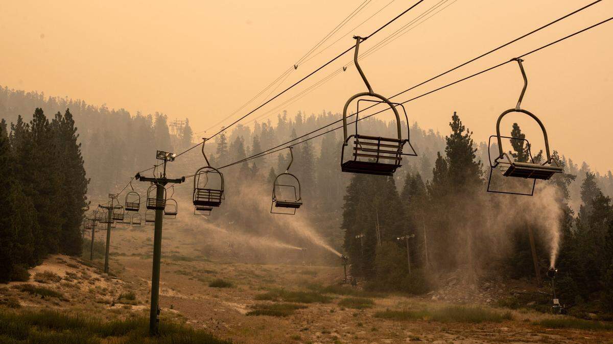
Tamarack Fire
The Tamarack Fire, once a major threat responsible for the destruction of several structures in California and Nevada, appears to be under control.
The fire has charred 68,696 acres near Markleeville and over the Nevada state line as of Tuesday night. The fire expanded minimally over the last four days and crews bumped containment up to 82%.
The Tamarack Fire was sparked by lightning July 4 and remained small and mostly inactive for weeks as the Forest Service decided to let it burn in the remote Mokelumne Wilderness. By mid-July, winds whipped up the blaze, and it burned into Markleeville, eventually pushing east through Alpine County into Nevada.
Alpine County officials have confirmed that at least 15 structures were destroyed by the fire. In Douglas County, Nevada, preliminary surveys showed 13 structures damaged or destroyed south of Leviathan Mine Road.
This story was originally published August 3, 2021 at 9:34 AM with the headline "Wildfire updates: Dixie Fire approaches towns of Chester and Greenville after explosive growth."
.JPG)