
One way to help heal Central Valley while correcting political favoritism
Who worries about flooding in time of drought?
Why should people care about fish in rivers, when farmers need that water for crops?
Could we really run out of groundwater because some farmers and cities pump too much?
Legal and political battles have been fought for decades over thorny questions like these. Answers and solutions seem as elusive as goodwill and cooperation. Climate change threatens to make all of it much worse.
But in the middle of this desert of despair arises an oasis of hope, an idea that might unite all sides and could turn each of these problems into positives.
Picture this: Uninhabited areas that periodically go under water when rivers swell over their banks, and no one minds, and wildlife thrives because of it. Cities, less concerned at the risk of floods like the one in January 1997 that damaged 1,800 homes around Modesto, causing $2 billion in damage and claiming nine lives. Some farmers are relieved that their land is likewise protected; others are thankful to have more plentiful groundwater because the floodplains continuously replenish it. The same goes for cities relying on aquifers for drinking water.
This win-win-win sounds too good to be true, you’re tempted to say, because you’re used to hearing and reading about California’s water wars and the seemingly unending rancor over our precious, limited resource.
You’re not wrong that water continues to be a major topic of contention, and may forever be.
But floodplains represent a literal pressure valve for the Stanislaus, Tuolumne, Merced and San Joaquin rivers, as well as a figurative one for easing the political strife over their best uses.
Ten miles west of Modesto, where the Tuolumne meets the San Joaquin, Dos Rios Ranch used to be marginal farmland that flooded six times between 1983 and 2007. The nonprofit River Partners and its allies bought land and turned it into a floodplain — a riverside preserve — in recent years.
Dos Rios was in the news just four weeks ago, when Governor Gavin Newsom announced that it will become a state park. Picnic benches, restrooms and trails could come within five years, and campgrounds after.
Take a good look at the main photo with this story. See how water from the nearby river spreads out over the land? That’s what we’re talking about: floodplains.
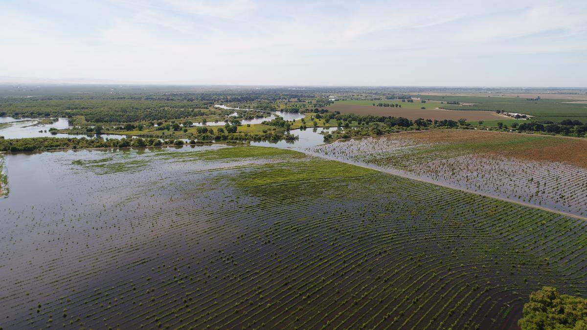
Much of the Valley used to look something like that in springtime 150 years ago, before dams and reservoirs began holding runoff from mountain snowpack for measured release to irrigation canals in the summer and fall. Levees also keep rivers channeled away from people and crops, particularly downriver. It works fairly well, until too much runoff overwhelms the system like it did 25 years ago, causing devastation.
But that was a once-in-a-lifetime event that we barely remember, and it can’t happen again, right?
Wrong. Recent studies now predict that peak flows will double in coming decades, and sometimes will be five times the current norm. The scope of potential damage and danger is stunning.
Wild weather swings
If the 1997 flood no longer strikes you with awe — or terror — think back only to October, when an atmospheric river dumped historic amounts of water on the Valley. December brought significant snow as well.
That was followed by the driest January on record, and nearly dry February and March, plunging us right back into drought conditions that persist to this day. Yet again.
This radical seesaw is what climate change looks like. And experts predict it will get much worse as snow becomes more scarce and rainfall heavier.
Disadvantaged communities of color are particularly vulnerable, because they abound where the Tuolumne flooded Modesto 25 years ago. This isn’t right.
Neither is the state’s disparate approach to floodplain planning, the emerging answer to some of our prickliest water problems.
Think of the Delta, where great rivers converge before dumping into the Pacific Ocean through the Golden Gate. In simple terms, the Sacramento River feeds the Delta from the north, and our San Joaquin River, from the south.
Here’s the problem: for every dollar spent on floodplain projects on the San Joaquin, state officials have spent $10 for such on the Sacramento. It’s political favoritism at its worst.
This whole discussion might appear as pointless as gun control legislation, but for one thing: the $100 billion California state budget surplus.
We have before us what could be a unique window to actually get something done on water, without friction.
Budget surplus to the rescue
The Modesto Bee calls on area representatives to raise their voices in support of setting some of that surplus money aside for floodplain projects on the San Joaquin and its tributaries, the Stanislaus, Tuolumne and Merced rivers.
Newsom has requested $132 million for unidentified flood management in his budget request. When details emerge, a significant portion must be targeted for projects protecting our San Joaquin region, not furthering the maddening inequity.
This window of opportunity could close in coming weeks as legislators put finishing touches on budget negotiations. “If we do not make progress in this budget, we could be stalled for years,” Barry Nelson, a water consultant, told The Bee’s editorial board.
Now is the time to strongly call for equity in advancing a worthy goal sought by farmers, municipalities, fisherpeople and environmentalists alike: floodplains.
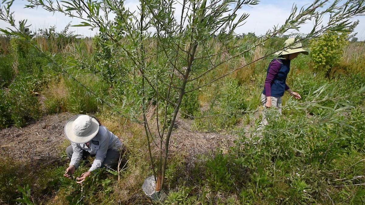
We need more Dos Rios floodplains. It’s easy to imagine several crisscrossing our Valley, allowing water to spread out and seep down, inviting rabbits and hawks and butterflies and trout and people to mini-paradises, leaving more groundwater available for cities and thriving farms.
We need state leaders to recognize that water isn’t only for fighting. Used right, this life source is indispensable for healing.